The Janke Family

Jeep

Summer!

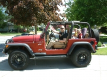
We have all been witnessing the quintessential signs of the beginning of spring/summer. April showers bringing May flowers, more time after work to kick the ball around with the boys because the sun is waiting for us to set, my neighbor parking their RV on their front lawn. And, perhaps the most defining, and definitely the most exciting, the Jeep going topless! We hope you are enjoying this great weather as much as we are!

Top of the World

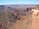
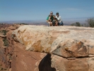
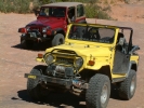
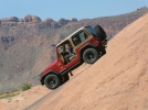
We spent last weekend in Moab with Dan & Beth (Mo’s Aunt and Uncle, Dan is Craig’s youngest Brother). We spent the majority of our time crawling around two Jeep trails, Top of the World and Fins & Things. We have run portions of Fins & Things before, but this time ran the entire trail. We did test the claim that Kenny’s climb is as dangerously steep as it is cracked up to be. Whoa! The two pictures on the right are from the Fins & Things trail. That’s Dan’s heavily modified yellow Cruiser (Skulls). The Top of the World trail starts up the Colorado River 29 miles at the Historic Dewey Bridge, and quite literally takes you to the top of the world. We were off pavement for about 19 miles. Ten of those miles were easy going washed out somewhat graded dirt road, five were pretty deliberate low range travel. The last two miles to the top and the first two miles back down (an approximately 4 mile one way loop at the top) were insane! There were some very intimidating ascents and descents. When first approached I wasn’t sure ol’ red could make it. But, I’ve been rattling around in a Jeep for many many years and have a really could sense of where to point a Jeep to make it climb like a billy goat. The view was amazing! From the top you can view the South side of the Fisher Towers (the second picture from the left), usually viewed from the Colorado River (to the North). You can also see Fisher Valley, the La Sal Mountains, Castle Valley, and even all the way to Arches. If you look closely at the third picture you will notice we are perched nicely on an overhang! What a view, it is still giving me butterflies!

Moab 2008

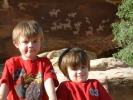
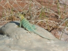
We ran down to Moab this weekend for a quick trip. What a great time! We hiked to Delicate Arch Friday evening, the boys are great hikers. We saw some great stuff, a giant frog, a collared lizard, Ute Indian petroglyphs, and some beautiful scenery. We ran the Fins & Things Jeep trail on Saturday morning and had a blast! It is in the Sand Flats Recreation Area (SFRA), that is where the Slickrock bike trail is. We also played around on Baby Lion’s Back a little bit while we were in the SFRA. We stayed at the Moab KOA in one of the “Kampin Kabins”. It had a full bed and a bunk bed in it, and a swing on the porch, it was great! We really love exploring the desert. Here are some pictures, hope you enjoy them.

Canyonlands Photos

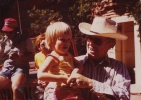
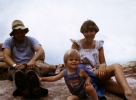
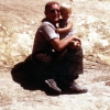
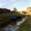
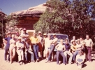
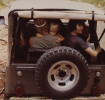
I found bins of old photos in Mom’s basement, I took some of them and have been slowly digitizing them to preserve them, also so all who wish a copy can enjoy them. The following photos are some photos of a “slightly” younger me ๐Ÿ™‚ in Canyonlands National Park with Mom and Dad, and Doctor Dave. The Jeep photo is in Salt Creek. The lead Jeep is Rick and Tina, followed by The Yankee Dollar (Linda) and Paul, then you can see The Grizzly Bear (Grandpa Lee) bringing up the rear. The group photo (Granny is sitting on the sand, bottom right) is at the Squaw Flats group camp site where we would always camp, which is in the Needles District of Canyonlands. Canyonlands National Park itself is 527 square miles of very remote, very beautiful high desert plateau back country. The park itself is broken up into three distinct land districts. Island in the Sky, the Needles, and the Maze District. The districts are divided by the Colorado and the Green Rivers. These two rivers confluence (join or converge) in the park. The Elephant Hill trail (in the Needles District), through Devil’s Pocket, Devil’s Lane, down the Silver Stairs, and a short hike will take you to an overlook of the Colorado & Green confluence that will take your breath away. Not to mention give you butt tingles. It is about a 1200 sheer face cliff down to the river, no safety rails! Be very careful!